Sunkhaze Meadows National Wildlife Refuge is 20 minutes from downtown Bangor. Getting there is half the fun. It’s a vast expanse of peat land, marsh, and wetland forest, though the interior is accessible only by canoe, and then only by dragging the boat over occasional beaver dams. The obstacles and the slow flow mean a long paddle, requiring plenty of time. It’s breeding habitat for American black ducks, hooded mergansers, ring-necked ducks, and both blue-winged and green-winged teal. Marsh wrens are common and noisy. American bitterns and great blue herons are abundant.
Several clusters of foot trails are available along the edges of the refuge. The Carter Meadow Road offers an excellent 2-mile round trip to an observation platform. This is the best view of the entire Sunkhaze Meadow from land. It’s also one of the better places near Bangor to chance upon moose. Least flycatchers are abundant over the first section, and boreal chickadees have been noted along the trail. A parking area and interpretive sign are just north of the trail entrance.
The Oak Point Trail is about 1.5 miles long. It is wet in the spring, though boardwalks help in the most challenging places. This trail traverses mostly upland forest but it does approach the peat bog.
The Johnson Brook Trail loops for about three miles through upland forest. A section through a cedar swamp also relies on boardwalks in the wettest areas. A parking lot and map kiosk serve this trailhead. All three trails begin on the County Road.
The Buzzy Brook Trail System is accessed from the Stud Mill Road close to where the power lines cross. The trail begins within the gated McLaughlin Road.
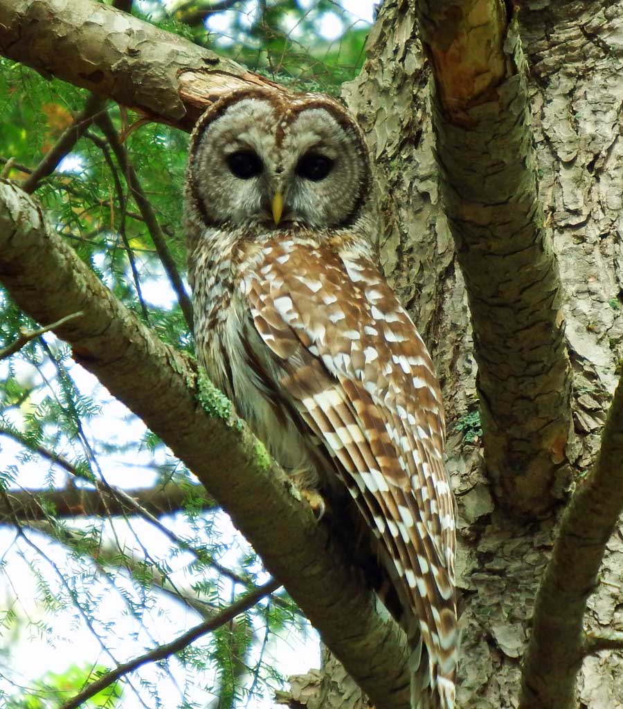
The County Road skirts the border of the refuge and provides a shortcut to the Stud Mill Road. From Milford, northbound on Route 2, turn right onto the County Road soon after the intersection with Route 178. The next eight miles traverse multiple woodland and marsh habitats. Barred and saw-whet owls can be heard at night on the stretch beyond the end of pavement. In the winter, finches and crossbills are possible, and crossbills will stay all summer in irruptive years.
The Stud Mill Road marks the northern boundary of the refuge. It is one of the roads that makes Maine “Maine.” This gravel superhighway runs from Route 2 in Milford to Route 1 in Princeton, crossing the Union, Narraguagus, and Machias Rivers en route. About five miles east of its intersection with the County Road, boreal habitat becomes entrenched along the roadway. Canada jays, boreal chickadees, and yellow-bellied flycatchers occupy this zone. Whip-poor-wills nest in scrubby areas. They are deafening in the spring, particularly beyond the Maine Youth Fish and Game Camp on Pickerel Pond. All stream crossings are worth an extra peek for warblers and thrushes. Much of the vegetation along the side of the road has been cleared for power transmission lines and a natural gas pipeline. These provide good habitat for American kestrels, and the occasional merlin and sharp-shinned hawk. In winter, it has become a hunting corridor for owls, and it can be possible to see barred owls in the sunlight of late afternoon.
The total distance from the Stud Mill/County Road intersection back to Route 2 is about three miles. Returning south on Route 2 will complete a 12-mile loop. Visit Ash Landing, a mile south of the County Road intersection. The view from the edge of this wetland often produces an unusual raptor or flycatcher. Hooded mergansers and wood ducks are regular occurrences. Check the bridge that crosses the Sunkhaze Stream about 2.3 miles south of the intersection. Cape May warblers have nested here in most years.