Bay Bridge Park is a secluded spot to scan part of Merrymeeting Bay for waterfowl. It is located on the back road between Brunswick and Bath. A former bridge across the Androscoggin River had an odd history. It was first constructed in 1835 and operated as a toll bridge until destroyed by flood in 1896. Tolls ranged from 3 cents for pedestrians to a full dollar for circus elephants. It was never profitable. Spring floods damaged the bridge and winter traffic simply bypassed the toll by crossing on the ice.
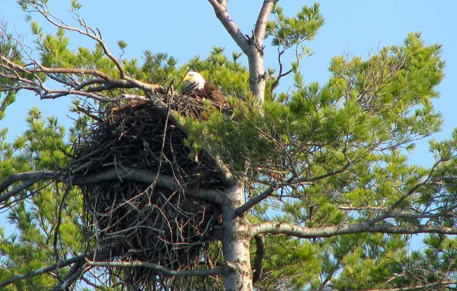
Today, the landing remains unchanged and, because it extends into the river, it affords views up and down stream. Marshy wetlands border both sides of the landing, and dabbling ducks compete for attention with the diving ducks in midstream. For many years, bald eagles have returned faithfully to a nest on Freyee Island about a third of a mile downstream, easily visible through binoculars. The brush and stunted secondary growth along the riverbank are prime habitats for common yellowthroats, American redstarts, and yellow and chestnut-sided warblers. Song and swamp sparrows are also present.
Directions: From Route 1, exit at Cook’s Corner/Route 24. Turn left onto the Brunswick-Bath Road. Go east for 0.4 miles, then turn left at the second light onto Old Bath Road and follow 2 miles. Go left at the sign for Bay Bridge Estates (a mobile home park) on Driscoll Street. Turn left at the stop sign and continue straight ahead to the community buildings at the end. The landing is to the right, on the river.
Bay Bridge Rd
Brunswick, ME 04011
GPS: 43.9348658,-69.8880672